Look a little closer
Roman roads often contain remarkably long straight sections because surveyors tried to connect military, administrative, and commercial nodes by direct, manageable alignments. They did not draw one ruler-straight line across every obstacle. A real route was commonly a chain of straight segments, with changes of direction where gradients, drainage, rivers, wet ground, existing tracks, or construction costs made a deviation sensible.
Directness suited the network's jobs. Major roads of the Republic helped move armies and supplies with greater speed and predictability; under the Empire, officials, the state transport system, traders, and local travelers also used them. Avoiding needless detours could reduce distance and sometimes the amount of road to build. That does not mean every road pointed to the city of Rome, or that a single military motive explains every branch of a network assembled over centuries.
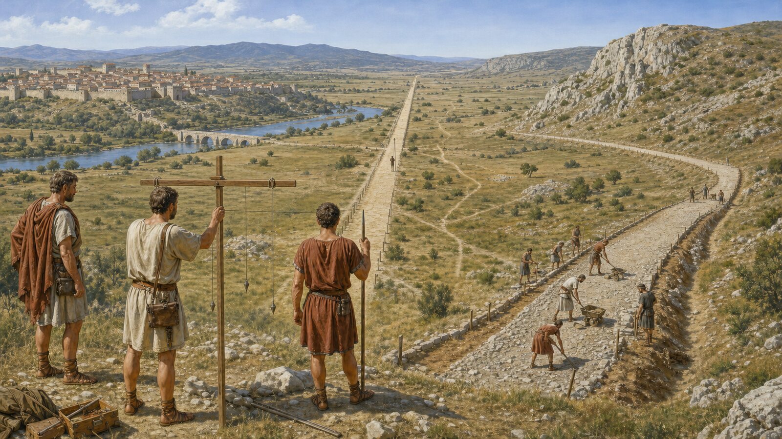
Keeping an alignment over distance required more than a good eye. A Roman surveyor's groma was a vertical staff with crossarms and hanging plumb lines. By sighting a ranging pole through paired strings, a surveyor could extend a straight line or set a right angle. On open ground, teams could establish one visible target after another and project a route in stages. The instrument was simple, but repeated observations could produce the conspicuous alignments that survive in roads and field boundaries.
The groma was not an automatic route planner. Surveyors still had to inspect the ground, judge slopes and soil, identify water, and decide what labor was practical. Archaeological traces in Britain frequently look less like one perfect ray than several long lines joined by modest angular corrections. Where plowing or later construction erased the surface, those alignments, associated ditches, and raised banks can still become clues in aerial photographs or topographic surveys.
A hill forced a calculation. Going around a low pass added distance but could give carts and pack animals a workable gradient and avoid enormous earthworks. A gentle ridge might instead be cut or banked so the road crossed it directly. Cliffs, deep valleys, marshes, and floodplains could compel substantial turns, while a river crossing had to meet a usable ford or bridge site. A bend on a map can therefore record an intelligent compromise, not a lapse in Roman surveying.
Construction also varied with place. On poorly drained ground, builders might raise an embankment, or agger, above the surroundings and dig side ditches. A cambered surface sent rain toward the edges. Gravel, broken stone, sand, and other locally available materials formed the road body and wearing surface, but the number and depth of layers differed with geology, date, and importance. The handsome fitted paving slabs familiar from photographs existed, yet they were never the universal surface of Roman roads.
That evidence undermines diagrams showing one mandatory Roman recipe everywhere. Literary descriptions can preserve ideals, while excavated roads reveal local materials, repairs, and rebuilding from different periods. A well-compacted gravel road is no less Roman than a paved urban street, and a minor link may be far simpler than an imperial artery. The achievement was not mechanical duplication; it was the repeated delivery of a stable, drainable, repairable route using the resources at hand.
Some routes also inherited older paths. Long before Roman rule, travelers knew ridgeways, passes, settlements, and reliable river crossings. Engineers widened or resurfaced portions of these lines and replaced other portions with more direct new construction. A straight section may signal deliberate Roman surveying, while a curve may preserve a much older geography of movement. Shape alone cannot securely date a road or identify its builders without excavation and surrounding evidence.
There is a visibility bias as well. Modern roads, hedges, and property boundaries sometimes reuse a Roman foundation, preserving an unmistakable axis. Curving ancient paths are harder to distinguish from natural contours or medieval tracks. Archaeologists therefore combine straightness with evidence of a bank, side ditches, road material, nearby sites, and datable finds. An unusually direct line is a useful reason to investigate; it is not, by itself, proof that legionaries built it.
Nor did a straight Roman road guarantee effortless travel. Surfaces deteriorated, seasonal water caused trouble, and steep sections or crossings remained difficult. Still, a prepared foundation, drainage, bridges, milestones, and connections to stopping places made movement more predictable than an unimproved track. Alignment was one component of that system, inseparable from construction and maintenance rather than a geometric trick that solved transport on its own.
The apparent straightness of Roman roads is best understood as a negotiated design. Surveyors used sight lines and plumb lines to create direct sections that were easy to set out, then changed course when the landscape made another choice better. To read a surviving route, look not for a flawless line across nature but for linked alignments, drainage works, local materials, and the obstacles they approach or avoid. Roman engineering becomes more impressive when seen as disciplined adaptation, not blind conquest of terrain.
EDITORIAL RESPONSIBILITY
FactosBrain Editorial Desk
The FactosBrain Editorial Desk researched and reviewed this article under our editorial policy. We assess error reports under our corrections policy.