Look a little closer
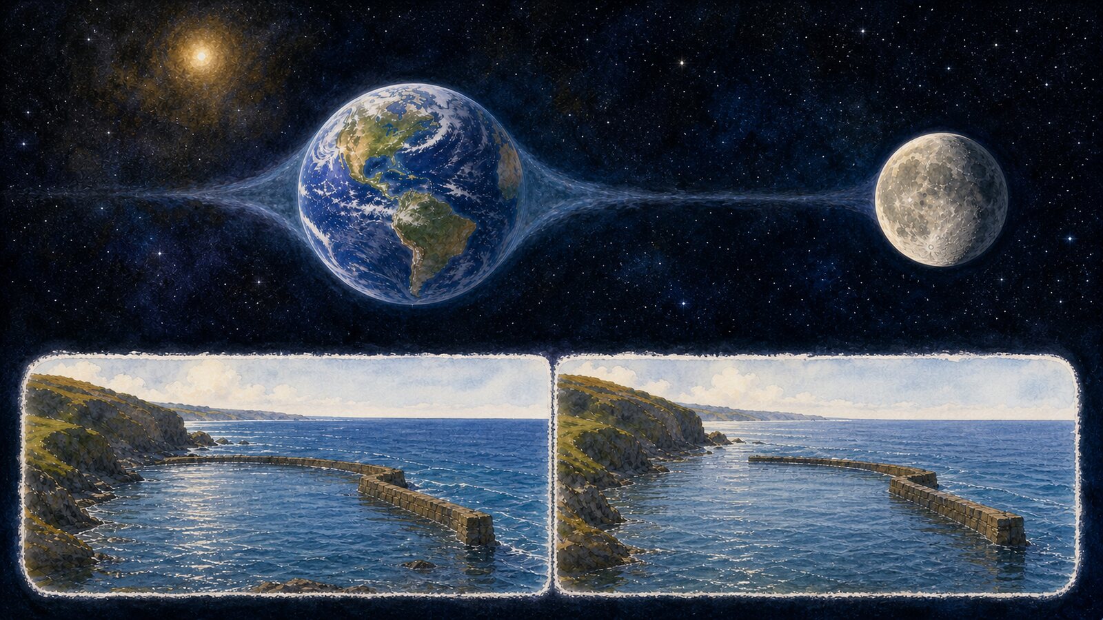
Most coasts receive two high tides because the Moon's gravity is not equally strong across the whole Earth, producing tidal deformation on both the Moon-facing and opposite sides, while Earth's rotation carries a location through both regions. The Moon moves eastward during that rotation, so the cycle follows a lunar day of about 24 hours 50 minutes rather than a 24-hour solar day. In an ideal semidiurnal tide, comparable high waters are roughly 12 hours 25 minutes apart.
The essential quantity is the difference in gravity. The near surface of Earth is pulled by the Moon a little more strongly than Earth's center, while the far surface is pulled a little less strongly. Relative to the motion of the center, that leaves one tide-producing component directed toward the Moon on the near side and another directed away from it on the far side. A picture in which the Moon lifts only the water immediately below it cannot account for the second high tide.
The fact that Earth and Moon orbit a common center of mass offers another description of the same physics. In a frame rotating with the pair, differential lunar gravity is combined with an inertial effect to describe the near- and far-side components. Saying that far-side water simply escapes the Moon, or that centrifugal force pushes only the ocean outward, is misleading. Land and water take part in Earth's motion; what matters for tides is the small positional difference left across the planet.
A point rotating through the two regions will generally experience two high and two low waters. The next high is not exactly twelve hours later, however. While Earth turns once, the Moon advances along its orbit in the same general direction. The coast must rotate for about fifty additional minutes to regain a similar orientation to the Moon. Lunar-dominated tide times consequently shift later by roughly fifty minutes from one day to the next.
The Sun raises tides too. It is enormously more massive than the Moon but also much farther away, so the difference in its gravitational pull across Earth is smaller. Near new and full moon, the solar and lunar tide-producing effects reinforce one another and create a larger tidal range called a spring tide. Near the quarter moons, their directions are closer to a right angle and the range is reduced in a neap tide. Spring here describes rising or leaping water, not the season.
Real oceans are not a smooth shell wrapped around an unobstructed planet. Continents block flow, seafloor depth changes wave speed, and bays or straits can concentrate or disperse energy. Earth's rotation introduces Coriolis effects that turn large-scale motion. It is therefore more accurate to think of tides as immense, long waves driven periodically by celestial forces and moving through ocean basins, rather than two permanent heaps of water fixed beneath and opposite the Moon.
A basin can amplify a tide when its natural period of sloshing lies near a tidal period. A narrowing, shallowing bay can raise the range further. Other places have modest changes, and water-level variation can become very small near points around which a tidal wave rotates. The fact that one harbor changes by meters while another under the same Moon changes little shows that coastlines and bathymetry actively reshape the astronomical input.
The phrase 'usually twice' therefore has important exceptions. A semidiurnal coast has two fairly similar highs and two lows in a lunar day. A mixed coast also has two of each, but consecutive highs or lows differ substantially in height. A predominantly diurnal region has only one high and one low per lunar day. Multiple astronomical constituents interact with a basin's response, so the timetable observed on one shore cannot be transferred to another.
The two-bulge sketch remains a useful first explanation, but it is not a calculator for a particular port. Local high water need not occur when the Moon is overhead, and the propagation of tidal waves around continents can introduce a large delay. Forecasting agencies analyze long water-level records as a combination of many periodic constituents. Those observations and local phase relationships are why each harbor needs its own tide table.
Weather and river flow can move the observed water level away from the predicted astronomical tide. Persistent onshore wind and low atmospheric pressure can add water, while opposite conditions can lower it. A storm surge is a weather-driven addition rather than a different astronomical tide, yet its overlap with high tide can greatly increase flooding. A forecast high and the water actually measured on a stormy day are related values, not guaranteed duplicates.
Two daily high tides are thus the visible rhythm of differential gravity, Earth-Moon motion, and ocean-basin dynamics—not merely the Moon tugging on one patch of sea. The basic interval near 12 hours 25 minutes comes from the two tidal components and the lunar day, but continents and the seafloor rearrange its local timing and size. Global physics explains the pattern; safe navigation and coastal decisions still require the forecast for the specific shore.
EDITORIAL RESPONSIBILITY
FactosBrain Editorial Desk
The FactosBrain Editorial Desk researched and reviewed this article under our editorial policy. We assess error reports under our corrections policy.