River bends are not evidence that water is “lazy” and deliberately chooses an easy route. They emerge from feedback among flowing water, bank erosion and sediment deposition. A small irregularity in the bed, an obstacle or a difference in bank material can initially deflect the current slightly to one side.
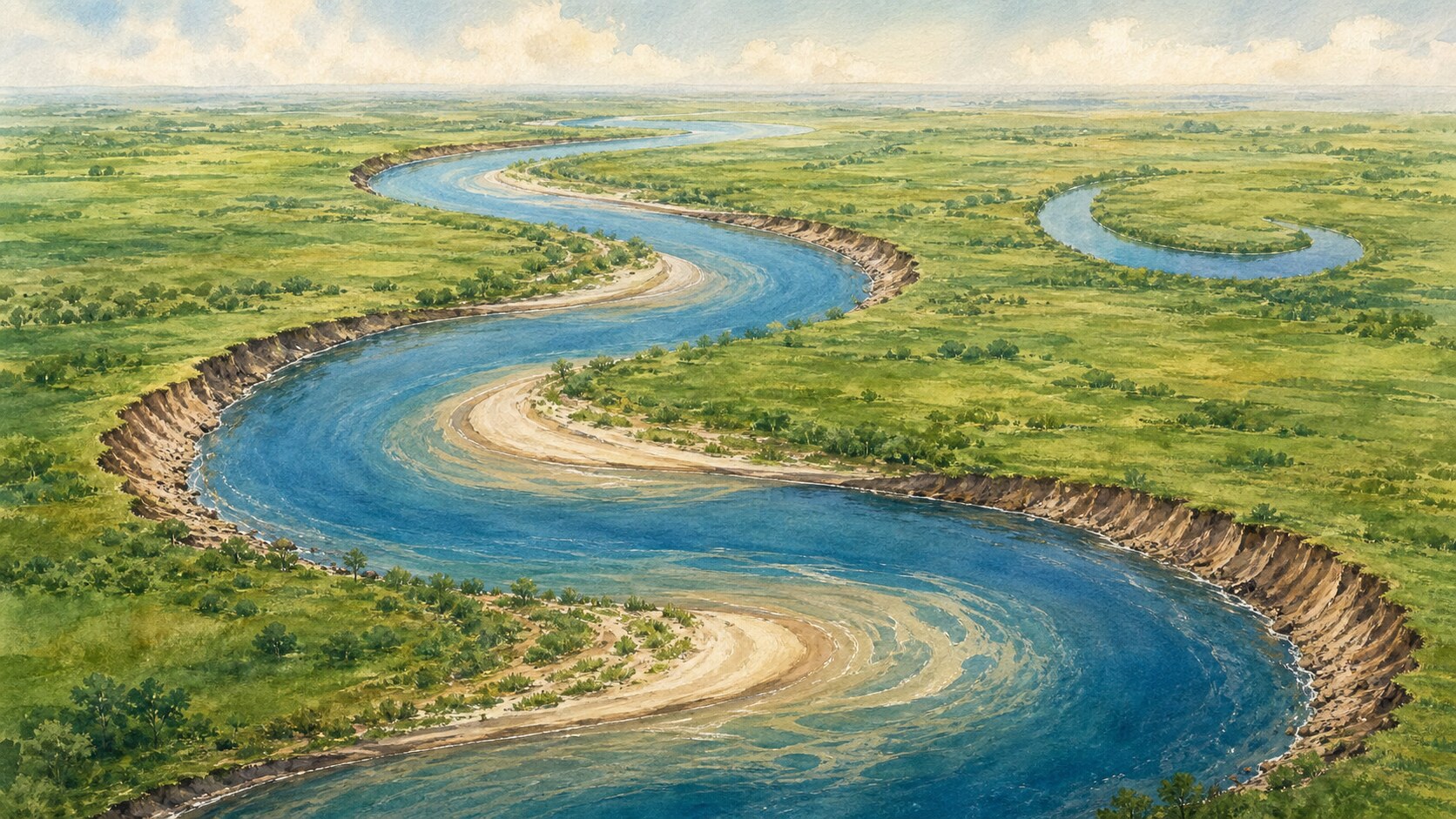
As flow enters a bend, its momentum carries it toward the outside, and the deepest, fastest part of the channel commonly shifts near the outer bank. Stronger shear stress erodes that bank and produces a steep cut bank. Collapsed soil and sediment arriving from upstream are then transported onward by the current.
The bend also contains more than surface water moving outward. Cross-channel pressure differences and friction along the bed generate secondary circulation, often described as a helical flow. This three-dimensional motion helps redistribute sediment. On the slower inner side, sand and gravel accumulate into a gently sloping deposit called a point bar.
Because the outer bank retreats while the inner bar grows, a bend becomes more pronounced and migrates sideways and downstream. An individual parcel of water does not always follow one neat line. Instead, the average pattern of erosion and deposition across ordinary flows and floods gradually rearranges the channel's planform.
Not every river meanders to the same degree. Discharge, valley slope, sediment size and supply, vegetation, bank cohesion and available floodplain width all constrain channel form. A stable, relatively gentle single channel may develop sweeping bends, while other combinations produce straighter reaches or braided networks with several shifting channels.
As neighboring loops enlarge, the neck of land between them can become narrow. During a flood, water may cut a shorter route across that neck and establish a new main channel. Sediment eventually seals the entrances of the abandoned loop, leaving the crescent-shaped water body known as an oxbow lake.
A meander is therefore moving terrain, not fixed decoration. Rivers deposit material across floodplains, erode property boundaries and continually remake habitats. The smooth curves on a map are not a precomputed shortest path. They are a record of water, movable sediment and resistant banks repeatedly changing one another over time.
EDITORIAL RESPONSIBILITY
FactosBrain Editorial Desk
The FactosBrain Editorial Desk researched and reviewed this article under our editorial policy. We assess error reports under our corrections policy.